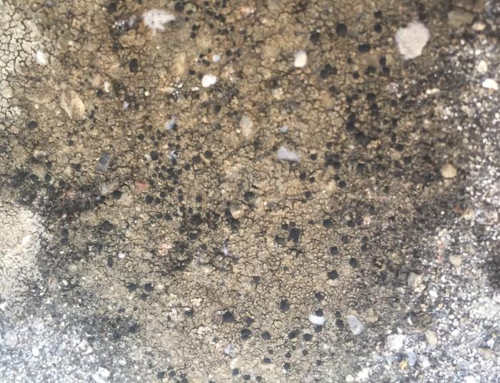
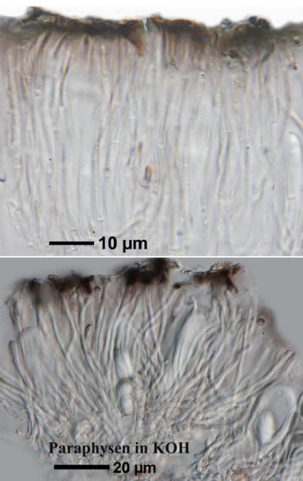
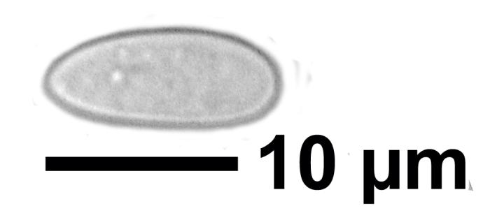
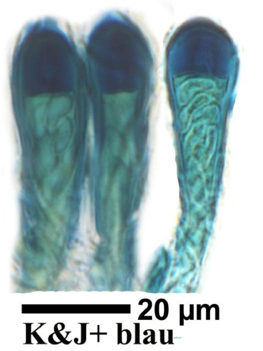
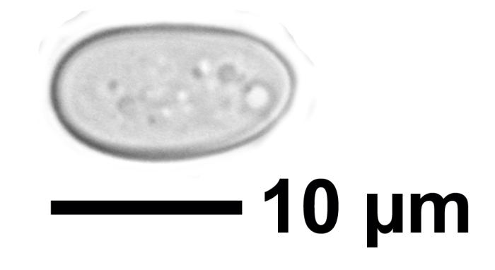
Lecidella stigmatea (Ach.) Hertel & Leuckert
, ABP: C00633
Lichen
Taxonomy
| Kingdom | Fungi |
| Phylum | Ascomycota |
| Subphylum | Pezizomycotina |
| Class | Lecanoromycetes |
| Order | Lecanorales |
| Family | Lecanoraceae |
| Genus | Lecidella |
| Specific Epithet | stigmatea |
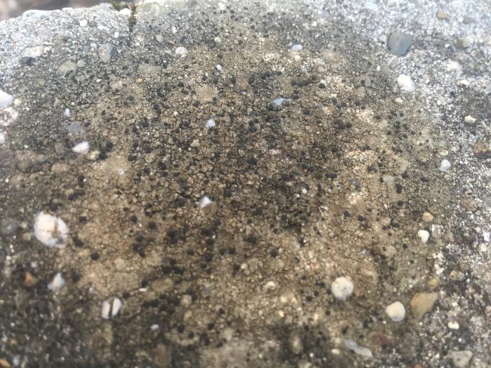
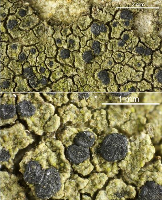
© Felix Schumm
| IMAGEID | 13445 |
| Identified By | Felix Schumm |
| Locality | Germany, Baden-Württemberg, Kreis Göppingen, bei Heiningen zwischen Sielenwang und Kornberg, Kalkste |
| Date | 1968-11-10 00:00:00 |
| Copyright | Felix Schumm |
| License | CC BY-SA 4.0 license |
| External Link | Open |
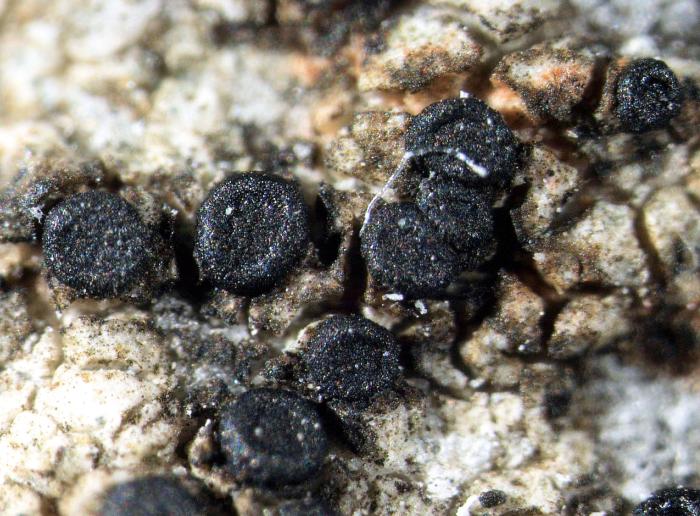
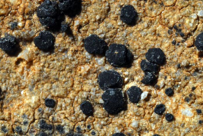
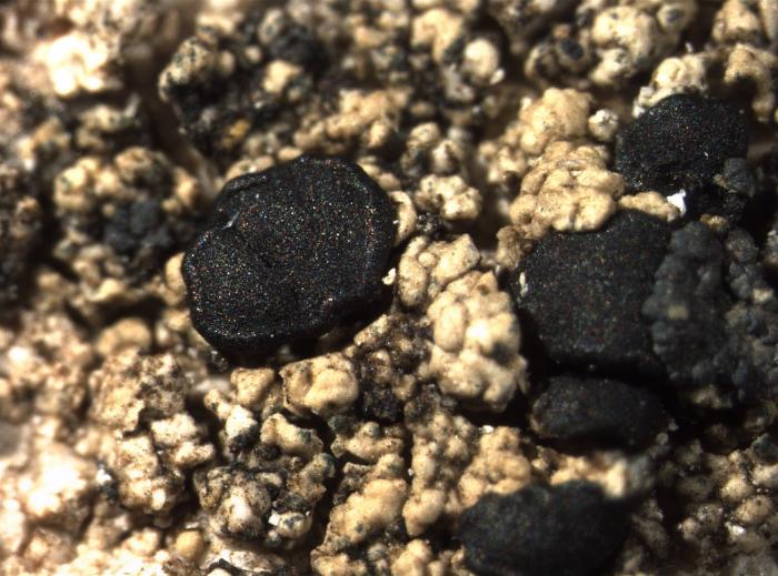
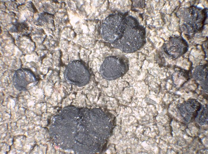
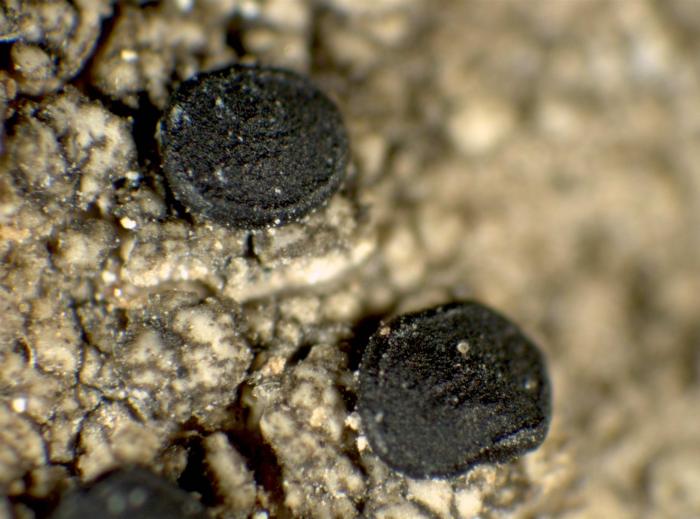
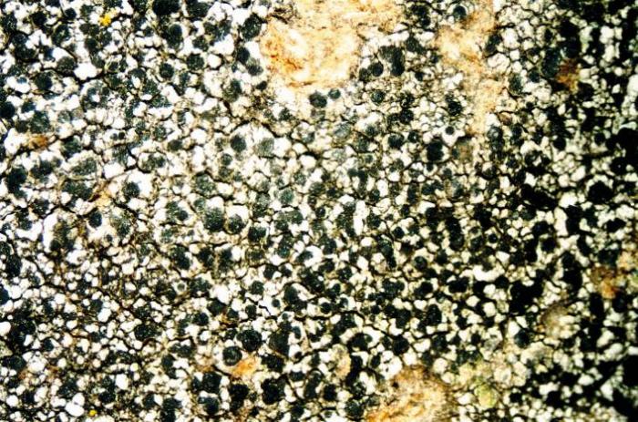
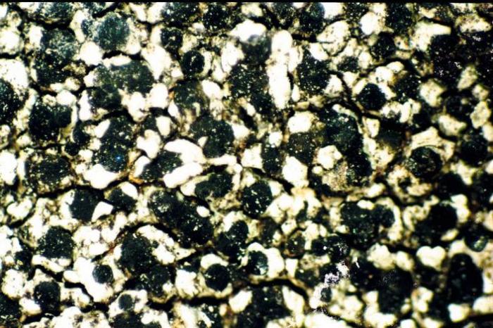
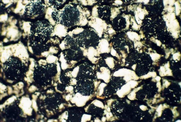
Photograph of a herbarium specimen taken through a dissecting microscope, x40. (Chemical spot tests on the medulla: K+ pale yellow, C-, PD-) / © Ed Uebel
| IMAGEID | 19013 |
| Description | Photograph of a herbarium specimen taken through a dissecting microscope, x40. (Chemical spot tests on the medulla: K+ pale yellow, C-, PD-) |
| Identified By | E. C. Uebel |
| Locality | EUA, Maryland, Baltimore, Owings Mills, N from Locust Run no Soldiers Delight Natural Environment Ar |
| Date | 2006-08-01 00:00:00 |
| Site Description | Growing on a boulder along the woodland edge on the western side of the high voltage power line clearing up hill |
| Copyright | Ed Uebel |
| License | CC BY-SA 3.0 |
| External Link | Open |
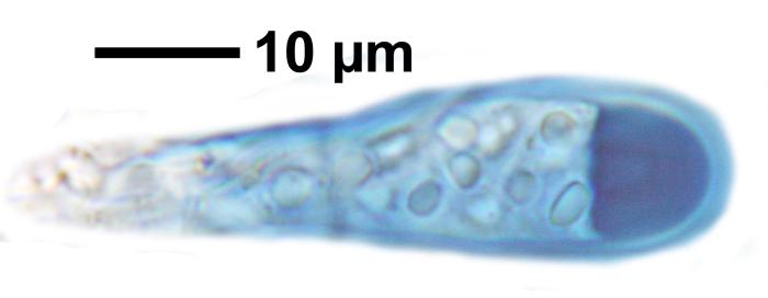
© Felix Schumm
| IMAGEID | 13446 |
| Identified By | Felix Schumm |
| Locality | Germany, Baden-Württemberg, Kreis Göppingen, bei Heiningen zwischen Sielenwang und Kornberg, Kalkste |
| Date | 1968-11-10 00:00:00 |
| Copyright | Felix Schumm |
| License | CC BY-SA 4.0 license |
| External Link | Open |
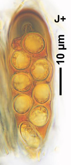
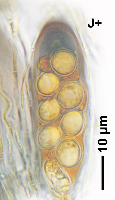
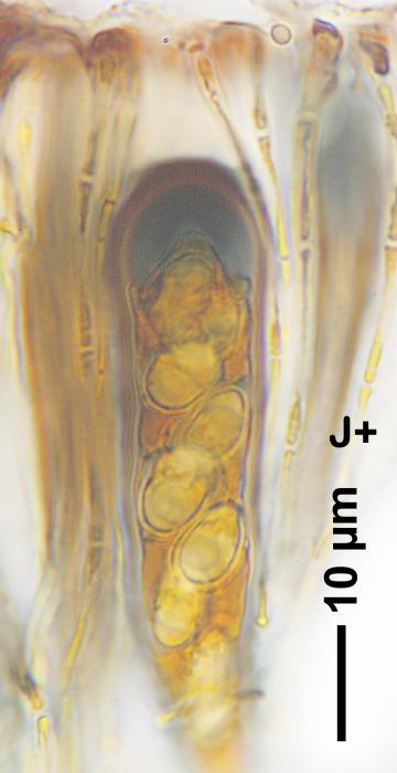
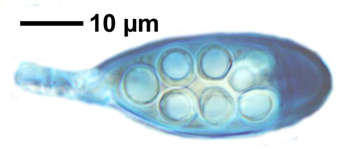
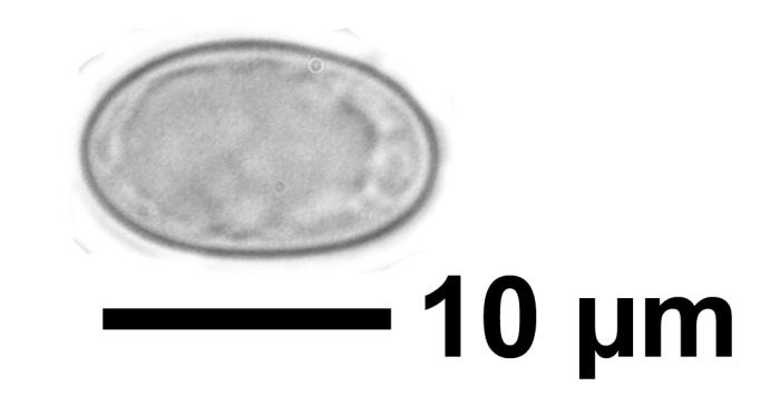
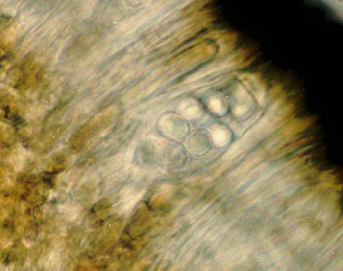
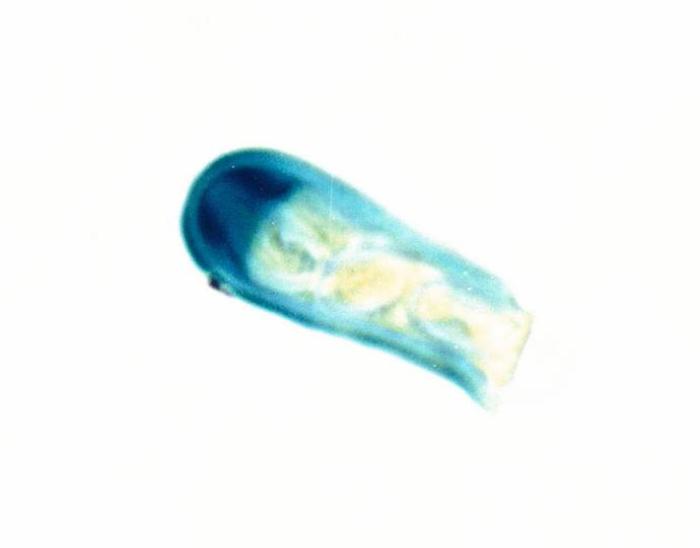
Photograph of an ascus from an apothecium of Lecidella stigmatea taken through a compound microscope (x1000), showing 8, simple, hyaline spores per ascus (spores measure 8 x 6 microns). / © Ed Uebel
| IMAGEID | 19014 |
| Description | Photograph of an ascus from an apothecium of Lecidella stigmatea taken through a compound microscope (x1000), showing 8, simple, hyaline spores per ascus (spores measure 8 x 6 microns). |
| Identified By | E. C. Uebel |
| Locality | EUA, Maryland, Baltimore, Owings Mills, N from Locust Run no Soldiers Delight Natural Environment Ar |
| Date | 2006-08-01 00:00:00 |
| Site Description | Growing on a boulder along the woodland edge on the western side of the high voltage power line clearing up hill |
| Copyright | Ed Uebel |
| License | CC BY-SA 3.0 |
| External Link | Open |
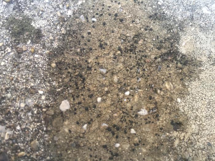
© Felix Schumm
| IMAGEID | 13447 |
| Identified By | Felix Schumm |
| Locality | Germany, Baden-Württemberg, Kreis Göppingen, bei Heiningen zwischen Sielenwang und Kornberg, Kalkste |
| Date | 1968-11-10 00:00:00 |
| Copyright | Felix Schumm |
| License | CC BY-SA 4.0 license |
| External Link | Open |
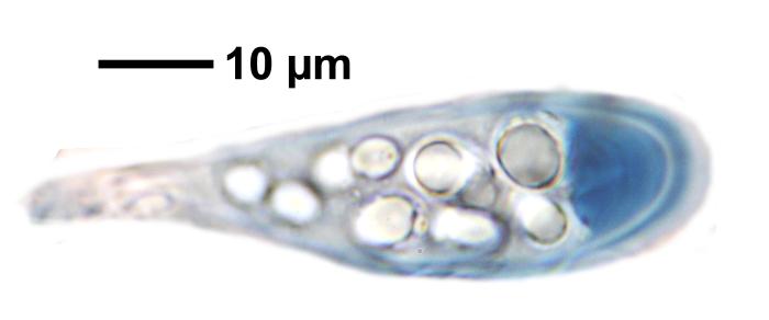
© Felix Schumm
| IMAGEID | 13448 |
| Identified By | Felix Schumm |
| Locality | Germany, Baden-Württemberg, Kreis Göppingen, bei Heiningen zwischen Sielenwang und Kornberg, Kalkste |
| Date | 1968-11-10 00:00:00 |
| Copyright | Felix Schumm |
| License | CC BY-SA 4.0 license |
| External Link | Open |
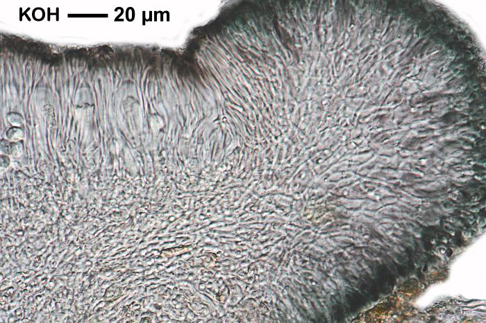
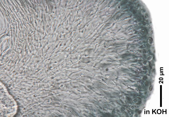
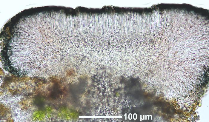
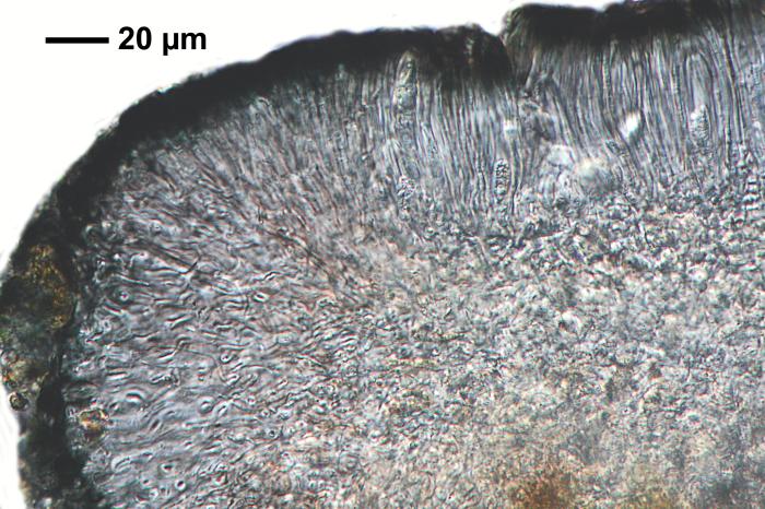
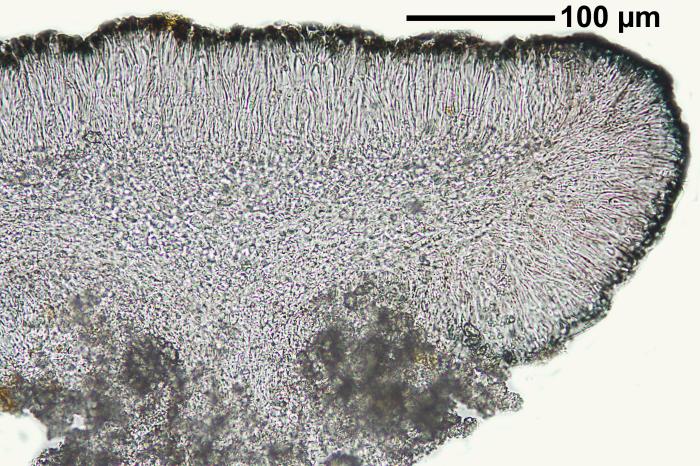
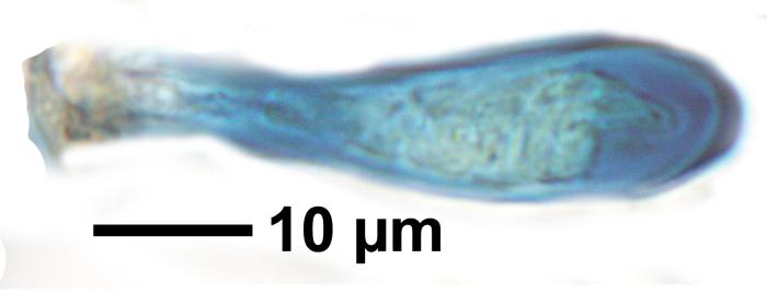
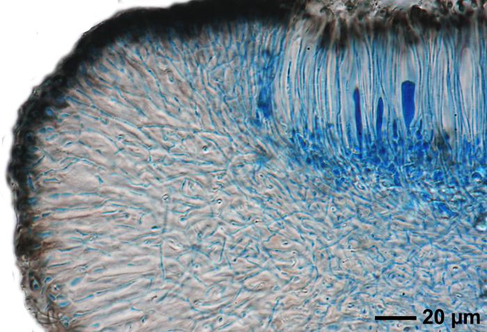
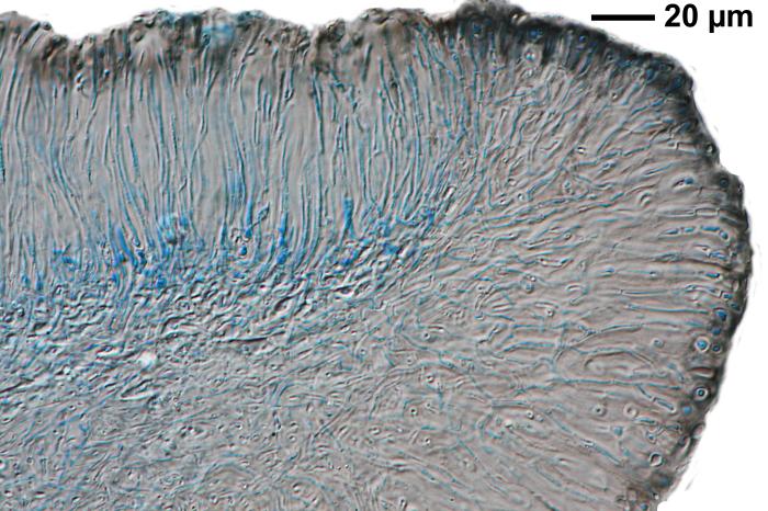
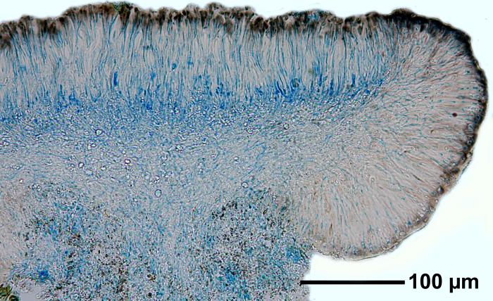
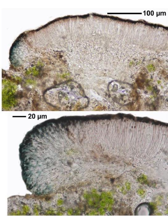
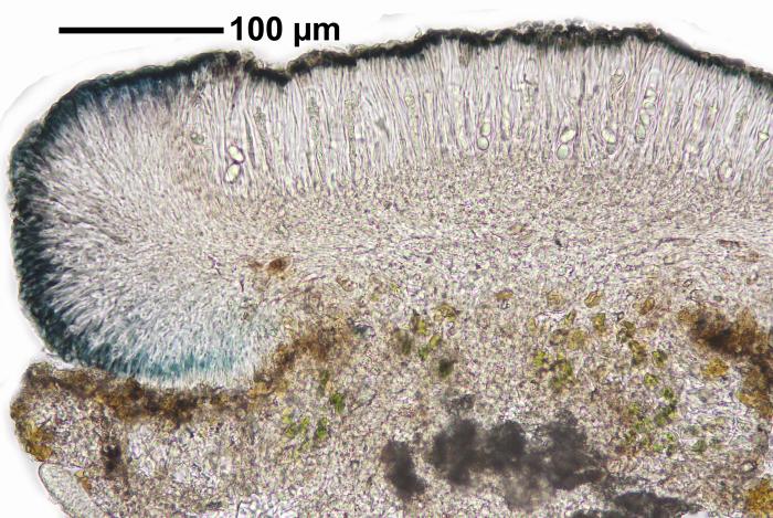
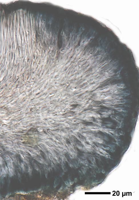
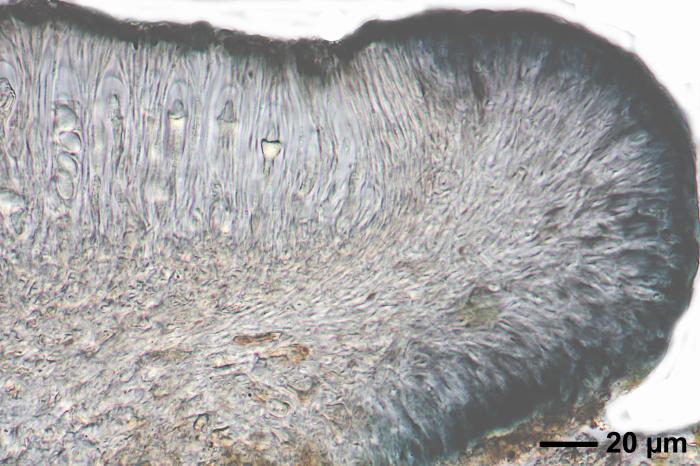
Photograph of a cross section of an apothecium of Lecidella stigmatea taken through a compound microscope (x400), showing a hyaline hypothecium. [Note: hypothecium of Lecidella carpathica is pale to midbrown.] / © Ed Uebel
| IMAGEID | 19016 |
| Description | Photograph of a cross section of an apothecium of Lecidella stigmatea taken through a compound microscope (x400), showing a hyaline hypothecium. [Note: hypothecium of Lecidella carpathica is pale to midbrown.] |
| Identified By | E. C. Uebel |
| Locality | EUA, Maryland, Baltimore, Owings Mills, N from Locust Run no Soldiers Delight Natural Environment Ar |
| Date | 2006-08-01 00:00:00 |
| Site Description | Growing on a boulder along the woodland edge on the western side of the high voltage power line clearing up hill |
| Copyright | Ed Uebel |
| License | CC BY-SA 3.0 |
| External Link | Open |
© Felix Schumm
| IMAGEID | 13449 |
| Identified By | Felix Schumm |
| Locality | Germany, Baden-Württemberg, Kreis Göppingen, bei Heiningen zwischen Sielenwang und Kornberg, Kalkste |
| Date | 1968-11-10 00:00:00 |
| Copyright | Felix Schumm |
| License | CC BY-SA 4.0 license |
| External Link | Open |
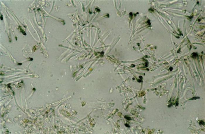
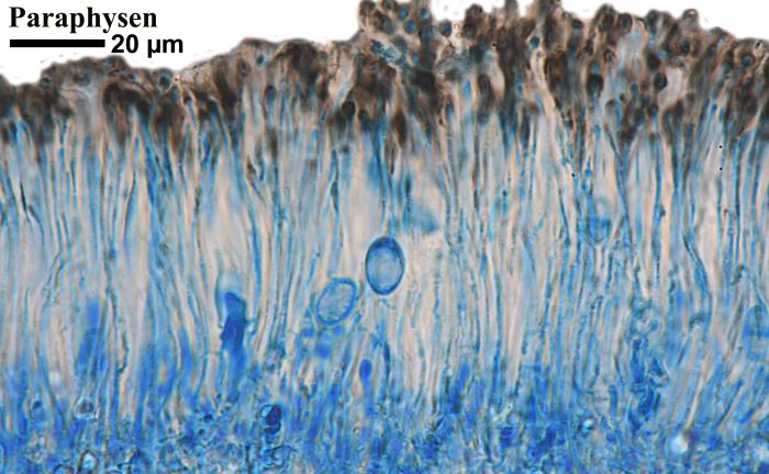
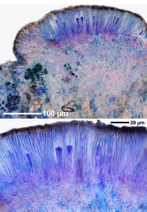
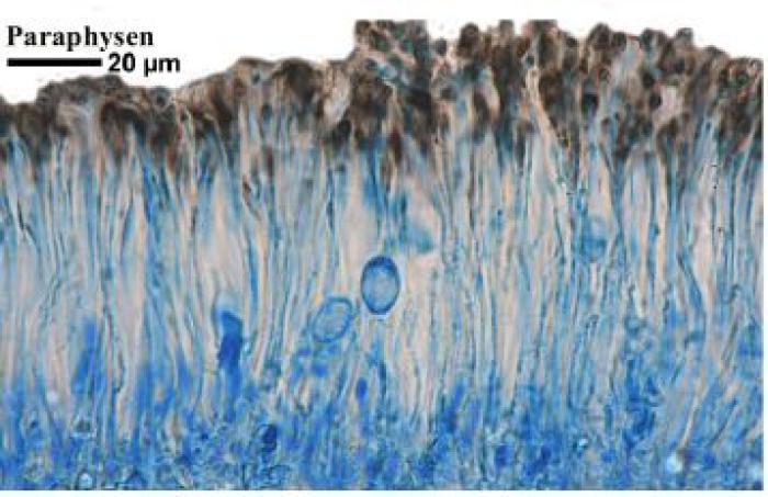
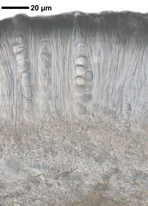
Photograph of a cross section of an apothecium of Lecidella stigmatea taken through a compound microscope (x1000), showing unbranched paraphyses that are easily separable in water. / © Ed Uebel
| IMAGEID | 19017 |
| Description | Photograph of a cross section of an apothecium of Lecidella stigmatea taken through a compound microscope (x1000), showing unbranched paraphyses that are easily separable in water. |
| Identified By | E. C. Uebel |
| Locality | EUA, Maryland, Baltimore, Owings Mills, N from Locust Run no Soldiers Delight Natural Environment Ar |
| Date | 2007-08-28 00:00:00 |
| Site Description | Growing on a boulder along the woodland edge on the western side of the high voltage power line clearing up hill |
| Copyright | Ed Uebel |
| License | CC BY-SA 3.0 |
| External Link | Open |
© Felix Schumm
| IMAGEID | 13450 |
| Identified By | Felix Schumm |
| Locality | Germany, Baden-Württemberg, Kreis Göppingen, bei Heiningen zwischen Sielenwang und Kornberg, Kalkste |
| Date | 1968-11-10 00:00:00 |
| Copyright | Felix Schumm |
| License | CC BY-SA 4.0 license |
| External Link | Open |
© Felix Schumm
| IMAGEID | 13451 |
| Identified By | Felix Schumm |
| Locality | Germany, Baden-Württemberg, Kreis Göppingen, bei Heiningen zwischen Sielenwang und Kornberg, Kalkste |
| Date | 1968-11-10 00:00:00 |
| Copyright | Felix Schumm |
| License | CC BY-SA 4.0 license |
| External Link | Open |
© Felix Schumm
| IMAGEID | 13452 |
| Identified By | Felix Schumm |
| Locality | Germany, Baden-Württemberg, Kreis Göppingen, bei Heiningen zwischen Sielenwang und Kornberg, Kalkste |
| Date | 1968-11-10 00:00:00 |
| Copyright | Felix Schumm |
| License | CC BY-SA 4.0 license |
| External Link | Open |
© Felix Schumm
| IMAGEID | 13453 |
| Identified By | Felix Schumm |
| Locality | Germany, Baden-Württemberg, Kreis Göppingen, bei Heiningen zwischen Sielenwang und Kornberg, Kalkste |
| Date | 1968-11-10 00:00:00 |
| Copyright | Felix Schumm |
| License | CC BY-SA 4.0 license |
| External Link | Open |
© Pier Luigi Nimis
| IMAGEID | 13424 |
| Copyright | Pier Luigi Nimis |
| License | CC BY-SA 4.0 license |
| External Link | Open |
© Felix Schumm
| IMAGEID | 13454 |
| Identified By | Felix Schumm |
| Locality | Germany, Baden-Württemberg, Schwäbische Alb, Kreis Reutlingen, 2.5 km westlich von Münsingen, Altes |
| Date | 2010-08-14 00:00:00 |
| Site Description | auf Kalkblock, 48.41935° N, 9.53646° E, 817 m |
| Copyright | Felix Schumm |
| License | CC BY-SA 4.0 license |
| External Link | Open |
© Domenico Puntillo
| IMAGEID | 13425 |
| Copyright | Domenico Puntillo |
| License | CC BY-SA 4.0 license |
| External Link | Open |
© Felix Schumm
| IMAGEID | 13455 |
| Identified By | Felix Schumm |
| Locality | Germany, Baden-Württemberg, Schwäbische Alb, Kreis Reutlingen, 2.5 km westlich von Münsingen, Altes |
| Date | 2010-08-14 00:00:00 |
| Site Description | auf Kalkblock, 48.41935° N, 9.53646° E, 817 m |
| Copyright | Felix Schumm |
| License | CC BY-SA 4.0 license |
| External Link | Open |
© Pier Luigi Nimis
| IMAGEID | 13426 |
| Copyright | Pier Luigi Nimis |
| License | CC BY-SA 4.0 license |
| External Link | Open |
© Felix Schumm
| IMAGEID | 13456 |
| Identified By | Felix Schumm |
| Locality | Germany, Baden-Württemberg, Schwäbische Alb, Kreis Reutlingen, 2.5 km westlich von Münsingen, Altes |
| Date | 2010-08-14 00:00:00 |
| Site Description | auf Kalkblock, 48.41935° N, 9.53646° E, 817 m |
| Copyright | Felix Schumm |
| License | CC BY-SA 4.0 license |
| External Link | Open |
© Pier Luigi Nimis
| IMAGEID | 13427 |
| Date | 2002-06-07 00:00:00 |
| Copyright | Pier Luigi Nimis |
| License | CC BY-SA 4.0 license |
| External Link | Open |
© Felix Schumm
| IMAGEID | 13457 |
| Identified By | Felix Schumm |
| Locality | Germany, Baden-Württemberg, Schwäbische Alb, Kreis Reutlingen, 2.5 km westlich von Münsingen, Altes |
| Date | 2010-08-14 00:00:00 |
| Site Description | auf Kalkblock, 48.41935° N, 9.53646° E, 817 m |
| Copyright | Felix Schumm |
| License | CC BY-SA 4.0 license |
| External Link | Open |
© Felix Schumm
| IMAGEID | 13458 |
| Identified By | Felix Schumm |
| Locality | Germany, Baden-Württemberg, Schwäbische Alb, Kreis Reutlingen, 2.5 km westlich von Münsingen, Altes |
| Date | 2010-08-14 00:00:00 |
| Site Description | auf Kalkblock, 48.41935° N, 9.53646° E, 817 m |
| Copyright | Felix Schumm |
| License | CC BY-SA 4.0 license |
| External Link | Open |
© Pier Luigi Nimis
| IMAGEID | 13429 |
| Locality | Italy, Friuli Venezia Giulia, Trieste, Trieste, Via Giorgieri |
| Date | 2017-02-12 00:00:00 |
| Copyright | Pier Luigi Nimis |
| License | CC BY-SA 4.0 license |
| External Link | Open |
© Felix Schumm
| IMAGEID | 13459 |
| Identified By | Felix Schumm |
| Locality | Germany, Baden-Württemberg, Schwäbische Alb, Kreis Reutlingen, 2.5 km westlich von Münsingen, Altes |
| Date | 2010-08-14 00:00:00 |
| Site Description | auf Kalkblock, 48.41935° N, 9.53646° E, 817 m |
| Copyright | Felix Schumm |
| License | CC BY-SA 4.0 license |
| External Link | Open |
© Pier Luigi Nimis
| IMAGEID | 13430 |
| Locality | Italy, Friuli Venezia Giulia, Trieste, Trieste, Via Giorgieri |
| Date | 2017-02-12 00:00:00 |
| Copyright | Pier Luigi Nimis |
| License | CC BY-SA 4.0 license |
| External Link | Open |
© Felix Schumm
| IMAGEID | 13460 |
| Identified By | Felix Schumm |
| Locality | Germany, Baden-Württemberg, Schwäbische Alb, Kreis Reutlingen, 2.5 km westlich von Münsingen, Altes |
| Date | 2010-08-14 00:00:00 |
| Site Description | auf Kalkblock, 48.41935° N, 9.53646° E, 817 m |
| Copyright | Felix Schumm |
| License | CC BY-SA 4.0 license |
| External Link | Open |
© Pier Luigi Nimis
| IMAGEID | 13431 |
| Locality | Italy, Friuli Venezia Giulia, Trieste, Trieste, Via Giorgieri |
| Date | 2017-02-12 00:00:00 |
| Copyright | Pier Luigi Nimis |
| License | CC BY-SA 4.0 license |
| External Link | Open |
© Felix Schumm
| IMAGEID | 13461 |
| Identified By | Felix Schumm |
| Locality | Germany, Baden-Württemberg, Schwäbische Alb, Kreis Reutlingen, 2.5 km westlich von Münsingen, Altes |
| Date | 2010-08-14 00:00:00 |
| Site Description | auf Kalkblock, 48.41935° N, 9.53646° E, 817 m |
| Copyright | Felix Schumm |
| License | CC BY-SA 4.0 license |
| External Link | Open |
© Pier Luigi Nimis
| IMAGEID | 13432 |
| Date | 2001-12-12 00:00:00 |
| Copyright | Pier Luigi Nimis |
| License | CC BY-SA 4.0 license |
| External Link | Open |
© Felix Schumm
| IMAGEID | 13462 |
| Identified By | Felix Schumm |
| Locality | Germany, Baden-Württemberg, Schwäbische Alb, Kreis Reutlingen, 2.5 km westlich von Münsingen, Altes |
| Date | 2010-08-14 00:00:00 |
| Site Description | auf Kalkblock, 48.41935° N, 9.53646° E, 817 m |
| Copyright | Felix Schumm |
| License | CC BY-SA 4.0 license |
| External Link | Open |
© Felix Schumm
| IMAGEID | 13433 |
| Identified By | Felix Schumm |
| Locality | Germany, Baden-Württemberg, Kreis Göppingen, bei Heiningen zwischen Sielenwang und Kornberg, Kalkste |
| Date | 1968-11-10 00:00:00 |
| Copyright | Felix Schumm |
| License | CC BY-SA 4.0 license |
| External Link | Open |
© Felix Schumm
| IMAGEID | 13463 |
| Identified By | Felix Schumm |
| Locality | Germany, Baden-Württemberg, Schwäbische Alb, Kreis Reutlingen, 2.5 km westlich von Münsingen, Altes |
| Date | 2010-08-14 00:00:00 |
| Site Description | auf Kalkblock, 48.41935° N, 9.53646° E, 817 m |
| Copyright | Felix Schumm |
| License | CC BY-SA 4.0 license |
| External Link | Open |
© Felix Schumm
| IMAGEID | 13434 |
| Identified By | Felix Schumm |
| Locality | Germany, Baden-Württemberg, Kreis Göppingen, bei Heiningen zwischen Sielenwang und Kornberg, Kalkste |
| Date | 1968-11-10 00:00:00 |
| Copyright | Felix Schumm |
| License | CC BY-SA 4.0 license |
| External Link | Open |
© Felix Schumm
| IMAGEID | 13464 |
| Identified By | Felix Schumm |
| Locality | Germany, Baden-Württemberg, Schwäbische Alb, Kreis Reutlingen, 2.5 km westlich von Münsingen, Altes |
| Date | 2010-08-14 00:00:00 |
| Site Description | auf Kalkblock, 48.41935° N, 9.53646° E, 817 m |
| Copyright | Felix Schumm |
| License | CC BY-SA 4.0 license |
| External Link | Open |
© Felix Schumm
| IMAGEID | 13435 |
| Locality | Germany, Baden-Württemberg, Kreis Göppingen, Messelstein bei Donzdorf, 48,69045° N, 9,83113° E, 750 |
| Date | 2010-07-25 00:00:00 |
| Site Description | an Kalkfelsen |
| Copyright | Felix Schumm |
| License | CC BY-SA 4.0 license |
| External Link | Open |
© Felix Schumm
| IMAGEID | 13465 |
| Identified By | Felix Schumm |
| Locality | Germany, Baden-Württemberg, Schwäbische Alb, Kreis Reutlingen, 2.5 km westlich von Münsingen, Altes |
| Date | 2010-08-14 00:00:00 |
| Site Description | auf Kalkblock, 48.41935° N, 9.53646° E, 817 m |
| Copyright | Felix Schumm |
| License | CC BY-SA 4.0 license |
| External Link | Open |
© Felix Schumm
| IMAGEID | 13436 |
| Locality | Germany, Baden-Württemberg, Kreis Göppingen, Messelstein bei Donzdorf, 48,69045° N, 9,83113° E, 750 |
| Date | 2010-07-25 00:00:00 |
| Site Description | an Kalkfelsen |
| Copyright | Felix Schumm |
| License | CC BY-SA 4.0 license |
| External Link | Open |
© Felix Schumm
| IMAGEID | 13466 |
| Identified By | Felix Schumm |
| Locality | Germany, Baden-Württemberg, Schwäbische Alb, Kreis Reutlingen, 2.5 km westlich von Münsingen, Altes |
| Date | 2010-08-14 00:00:00 |
| Site Description | auf Kalkblock, 48.41935° N, 9.53646° E, 817 m |
| Copyright | Felix Schumm |
| License | CC BY-SA 4.0 license |
| External Link | Open |
© Felix Schumm
| IMAGEID | 13437 |
| Locality | Germany, Baden-Württemberg, Kreis Göppingen, Messelstein bei Donzdorf, 48,69045° N, 9,83113° E, 750 |
| Date | 2010-07-25 00:00:00 |
| Site Description | an Kalkfelsen |
| Copyright | Felix Schumm |
| License | CC BY-SA 4.0 license |
| External Link | Open |
© Felix Schumm
| IMAGEID | 13467 |
| Identified By | Felix Schumm |
| Locality | Germany, Baden-Württemberg, Schwäbische Alb, Kreis Reutlingen, 2.5 km westlich von Münsingen, Altes |
| Date | 2010-08-14 00:00:00 |
| Site Description | auf Kalkblock, 48.41935° N, 9.53646° E, 817 m |
| Copyright | Felix Schumm |
| License | CC BY-SA 4.0 license |
| External Link | Open |
© Felix Schumm
| IMAGEID | 13438 |
| Locality | Germany, Baden-Württemberg, Kreis Göppingen, Messelstein bei Donzdorf, 48,69045° N, 9,83113° E, 750 |
| Date | 2010-07-25 00:00:00 |
| Site Description | an Kalkfelsen |
| Copyright | Felix Schumm |
| License | CC BY-SA 4.0 license |
| External Link | Open |
© Felix Schumm
| IMAGEID | 13468 |
| Identified By | Felix Schumm |
| Locality | Germany, Baden-Württemberg, Schwäbische Alb, Kreis Reutlingen, 2.5 km westlich von Münsingen, Altes |
| Date | 2010-08-14 00:00:00 |
| Site Description | auf Kalkblock, 48.41935° N, 9.53646° E, 817 m |
| Copyright | Felix Schumm |
| License | CC BY-SA 4.0 license |
| External Link | Open |
© Felix Schumm
| IMAGEID | 13439 |
| Locality | Germany, Baden-Württemberg, Kreis Göppingen, Messelstein bei Donzdorf, 48,69045° N, 9,83113° E, 750 |
| Date | 2010-07-25 00:00:00 |
| Site Description | an Kalkfelsen |
| Copyright | Felix Schumm |
| License | CC BY-SA 4.0 license |
| External Link | Open |
© Felix Schumm
| IMAGEID | 13469 |
| Identified By | Felix Schumm |
| Locality | Germany, Baden-Württemberg, Schwäbische Alb, Kreis Reutlingen, 2.5 km westlich von Münsingen, Altes |
| Date | 2010-08-14 00:00:00 |
| Site Description | auf Kalkblock, 48.41935° N, 9.53646° E, 817 m |
| Copyright | Felix Schumm |
| License | CC BY-SA 4.0 license |
| External Link | Open |
© Felix Schumm
| IMAGEID | 13440 |
| Locality | Germany, Baden-Württemberg, Kreis Göppingen, Messelstein bei Donzdorf, 48,69045° N, 9,83113° E, 750 |
| Date | 2010-07-25 00:00:00 |
| Site Description | an Kalkfelsen |
| Copyright | Felix Schumm |
| License | CC BY-SA 4.0 license |
| External Link | Open |
© Felix Schumm
| IMAGEID | 13470 |
| Identified By | Felix Schumm |
| Locality | Germany, Baden-Württemberg, Schwäbische Alb, Kreis Reutlingen, 2.5 km westlich von Münsingen, Altes |
| Date | 2010-08-14 00:00:00 |
| Site Description | auf Kalkblock, 48.41935° N, 9.53646° E, 817 m |
| Copyright | Felix Schumm |
| License | CC BY-SA 4.0 license |
| External Link | Open |
© Felix Schumm
| IMAGEID | 13441 |
| Identified By | Felix Schumm |
| Locality | Germany, Baden-Württemberg, Schwäbische Alb, Kreis Reutlingen, 2.5 km westlich von Münsingen, „Altes |
| Date | 2010-08-14 00:00:00 |
| Site Description | auf Kalkblock, 48.41935° N, 9.53646° E, 817 m |
| Copyright | Felix Schumm |
| License | CC BY-SA 4.0 license |
| External Link | Open |
© Felix Schumm
| IMAGEID | 13471 |
| Identified By | Felix Schumm |
| Locality | Germany, Baden-Württemberg, Schwäbische Alb, Kreis Reutlingen, 2.5 km westlich von Münsingen, Altes |
| Date | 2010-08-14 00:00:00 |
| Site Description | auf Kalkblock, 48.41935° N, 9.53646° E, 817 m |
| Copyright | Felix Schumm |
| License | CC BY-SA 4.0 license |
| External Link | Open |
© Felix Schumm
| IMAGEID | 13442 |
| Identified By | Felix Schumm |
| Locality | Germany, Baden-Württemberg, Schwäbische Alb, Kreis Reutlingen, 2.5 km westlich von Münsingen, „Altes |
| Date | 2010-08-14 00:00:00 |
| Site Description | auf Kalkblock, 48.41935° N, 9.53646° E, 817 m |
| Copyright | Felix Schumm |
| License | CC BY-SA 4.0 license |
| External Link | Open |
© Pier Luigi Nimis
| IMAGEID | 13472 |
| Copyright | Pier Luigi Nimis |
| License | CC BY-SA 4.0 license |
| External Link | Open |
© Felix Schumm
| IMAGEID | 13443 |
| Identified By | Felix Schumm |
| Locality | Germany, Baden-Württemberg, Schwäbische Alb, Kreis Reutlingen, 2.5 km westlich von Münsingen, „Altes |
| Date | 2010-08-14 00:00:00 |
| Site Description | auf Kalkblock, 48.41935° N, 9.53646° E, 817 m |
| Copyright | Felix Schumm |
| License | CC BY-SA 4.0 license |
| External Link | Open |
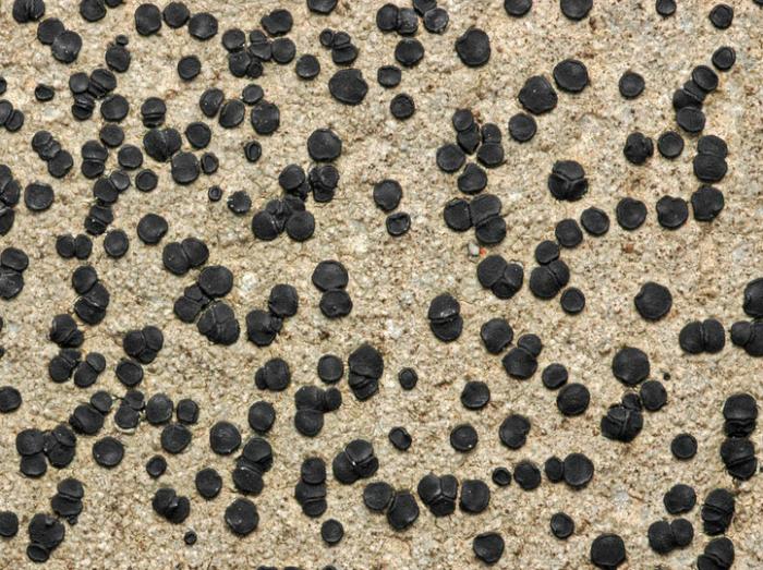
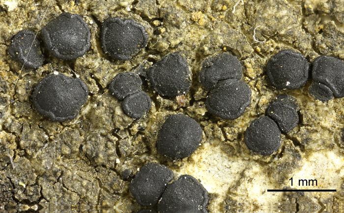
Photograph of a herbarium specimen taken through a dissecting microscope, x8. (Chemical spot tests on the medulla: K+ pale yellow, C-, PD-) / © Ed Uebel
| IMAGEID | 19011 |
| Description | Photograph of a herbarium specimen taken through a dissecting microscope, x8. (Chemical spot tests on the medulla: K+ pale yellow, C-, PD-) |
| Identified By | E. C. Uebel |
| Locality | EUA, Maryland, Baltimore, Owings Mills, N from Locust Run no Soldiers Delight Natural Environment Ar |
| Date | 2006-08-01 00:00:00 |
| Site Description | Growing on a boulder along the woodland edge on the western side of the high voltage power line clearing up hill |
| Copyright | Ed Uebel |
| License | CC BY-SA 3.0 |
| External Link | Open |
© Felix Schumm
| IMAGEID | 13444 |
| Identified By | Felix Schumm |
| Locality | Germany, Baden-Württemberg, Kreis Göppingen, bei Heiningen zwischen Sielenwang und Kornberg, Kalkste |
| Date | 1968-11-10 00:00:00 |
| Copyright | Felix Schumm |
| License | CC BY-SA 4.0 license |
| External Link | Open |

![Photograph of a cross section of an apothecium of Lecidella stigmatea taken through a compound microscope (x400), showing a hyaline hypothecium. [Note: hypothecium of Lecidella carpathica is pale to midbrown.] / © Ed Uebel](/imagensEspecies/1/1/1/7/0/lecidella-stigmatea-t00270-209.jpg)
